


To prepare for your visit, please check the conditions of access.
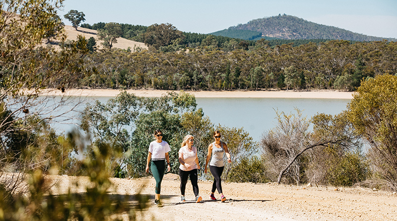
 Walking/running
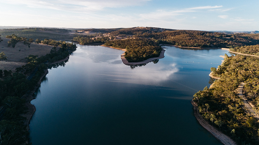
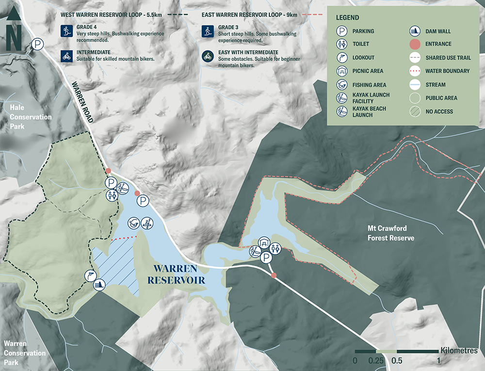
Two loop trails within the reservoir reserve offer great bushwalking experiences. The 5.5km Western Loop and the 9km Eastern Loop are both unsealed, suitable for walking and running, and they offer water views.
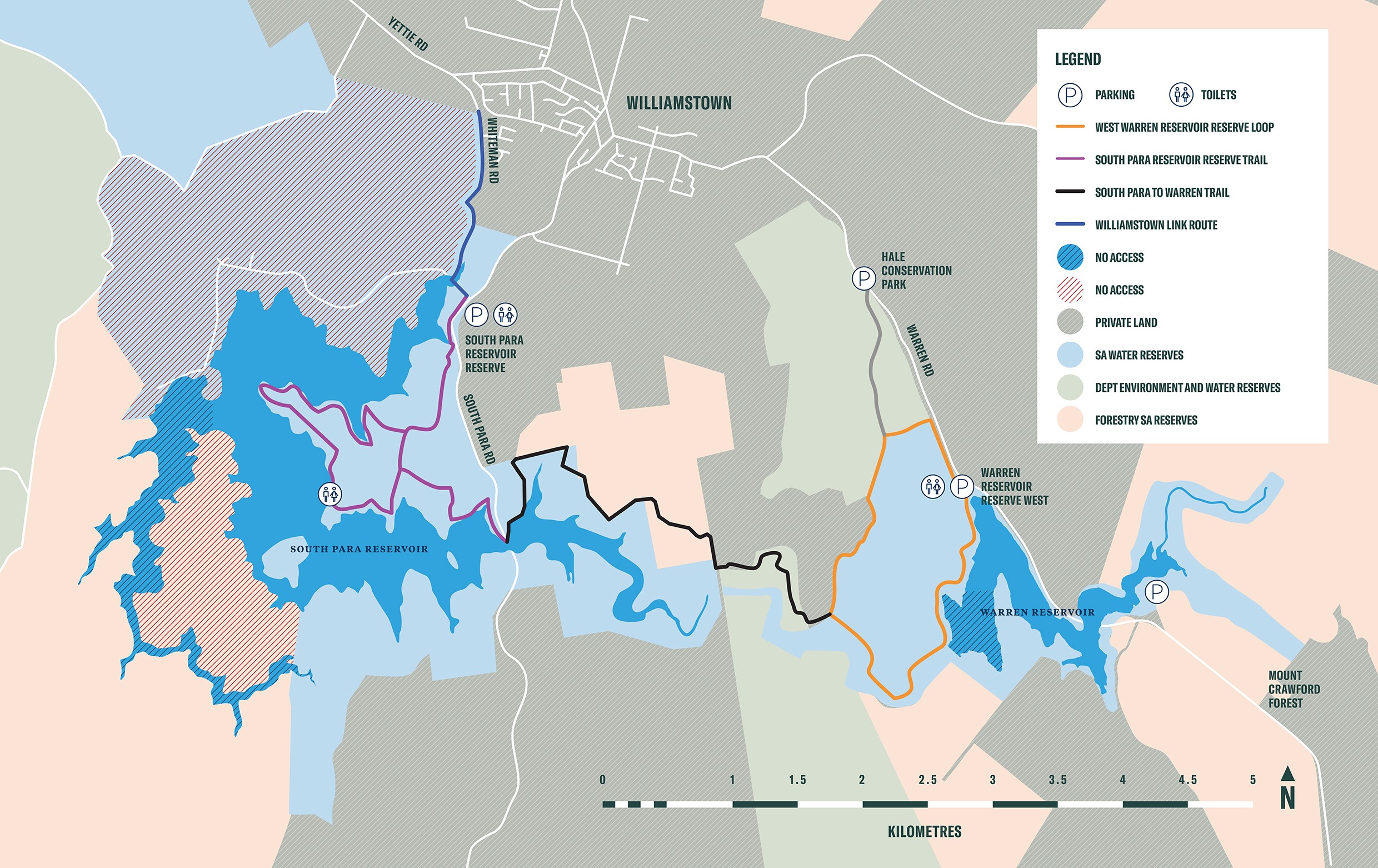
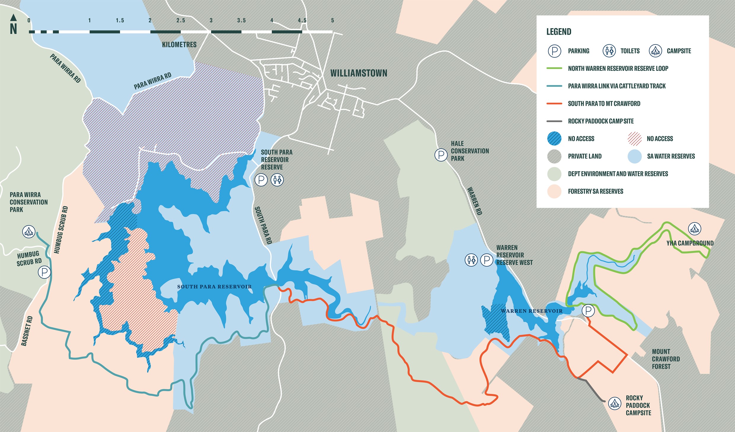
The Western Loop also forms part of a link trail to South Para Reservoir Reserve, over a total 7km trail, while the Eastern Loop links in to more than 20km of trails to take hikers through Mt Crawford Forest, adjacent South Para Reservoir Reserve and on to Para Wirra Conservation Park. Some hiking experience and planning for the longer journeys, connecting to campsites, is recommended.
 Fishing
With a fishing permit, you can drop a line in the from the shoreline in the public access area or on the water from a kayak or canoe.
The reservoir is stocked with Murray cod (catch and release), golden perch and silver perch. Fishing limits are detailed on PIRSA's website.
 Cycling
The 5.5km Western Loop stretches along the reservoir shore and around the reserve’s bushland, linking with a trail to South Para Reservoir Reserve, while the 9km Eastern Loop takes you around the eastern section of the reservoir and waterways that feed into it, linking to more than 20km of trails in the region. The unsealed trails are more suited to mountain bikes than road bikes. Both are shared use trails for cyclists and walkers, so please be considerate of other trail users.
 Kayaking/canoeing
There are two launch areas at Warren for kayaking and canoeing. Take in the surrounding landscape from the water. With a fishing permit, you can also drop a line from your kayak or canoe.
There is a wheelchair ramp leading to an all-accessibility kayak facility located at the Tower Entrance. Please note, there is no storage for wheelchairs on or near the launch facility.
Please note, there are no lifesaving services or resources at Warren Reservoir.
 Dam wall lookout
A short walk from the western car park is a vantage point to view the dam wall and reservoir.
 Picnicking
There are three picnic areas for you to enjoy, of which two have toilet facilities and are fully accessible for people with limited mobility.
![]() Dogs are not welcome at reservoir reserves as they can carry harmful organisms that can easily contaminate the water and they pose a threat to local native birds and wildlife. Assistance animals are accepted.
Dogs are not welcome at reservoir reserves as they can carry harmful organisms that can easily contaminate the water and they pose a threat to local native birds and wildlife. Assistance animals are accepted.
![]() Swimming is not permitted at any of our reservoirs because it involves direct contact with the water above the knee and risks contamination of the water by the harmful pathogens carried by humans.
Swimming is not permitted at any of our reservoirs because it involves direct contact with the water above the knee and risks contamination of the water by the harmful pathogens carried by humans.
For the same reason, other activities that involve wading above the knee or present a high chance of failing or jumping in the water are not permitted.
Blue-green algae
Algae is a common occurrence in open water sources, including reservoirs and the River Murray, especially during warmer months of the year when conditions are favourable for growth.
SA Water samplers, operators and scientists actively monitor and test the source water and connecting water networks during these times and adjust treatment processes as needed. This ensures they continue to supply safe, clean drinking water to their customers.
Some blue-green algae species produce compounds which can be harmful to humans and animals. Contact with untreated water in a reservoir where algae are present can be harmful to your health.
When blue-green algae levels are increasing, and related water treatment or algal management activities are being conducted, the site will be closed to visitors until 1pm that day. There will be clear signage at the entrance and on this website page.
To find out more, read SA Health’s information about blue-green algae health impacts and how to avoid illness.
Click map below for a print-friendly version.
Extended trail network
Maps on your mobile
If you have a smartphone or tablet you can download the free Avenza Map app and have interactive reservoir reserve maps on hand when you need them.
The app uses your device’s built-in GPS to plot your real-time location within the reserve onto a map. The app can be used without a network connection and without roaming charges. You can also measure area and distance, plot photos and drop placemark pins.
How to get it working on your device:
1. Download the Avenza Maps app from the app store (iOS/Android) whilst you are still in range (its free!).
2. Open up the app and click the shopping cart icon.
3. Click ‘Find’ and type the name of the reservoir reserve you are looking for.
4. Click on the map you are after and install it (all our maps are free).
5. You will now find a list of your installed maps on the home page of the Avenza Maps app.
6. Use our maps through the Avenza Mapa app while in the reserve and never take a wrong turn again.